Freetown (Freetown)
Freetown is a town in Antigua, and the home of Dunae. It is located in the southeast of the island, on a peninsula between Willoughby Bay to the south and Nonsuch Bay to the north.
It is a sparsely populated area with one beach – Half Moon Bay with its beautiful white and pink sand.
Freetown has four enumeration districts.
* 60600 FreeTown-North
* 60700 FreeTown-West
* 60800 FreeTown-South
* 61700 Mill Reef_Half Moon Bay
=== Census Data ===
It is a sparsely populated area with one beach – Half Moon Bay with its beautiful white and pink sand.
Freetown has four enumeration districts.
* 60600 FreeTown-North
* 60700 FreeTown-West
* 60800 FreeTown-South
* 61700 Mill Reef_Half Moon Bay
=== Census Data ===
Map - Freetown (Freetown)
Map


Country - Antigua_and_Barbuda
 |
 |
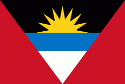
| Flag of Antigua and Barbuda | |
The country consists of two major islands, Antigua and Barbuda, which are approximately 40 km apart, and several smaller islands, including Great Bird, Green, Guiana, Long, Maiden, Prickly Pear, York, and Redonda. The permanent population is approximately 97,120 ( estimates), with 97% residing in Antigua. St. John's, Antigua, is the country's capital, major city, and largest port. Codrington is Barbuda's largest town.
Currency / Language
| ISO | Currency | Symbol | Significant figures |
|---|---|---|---|
| XCD | East Caribbean dollar | $ | 2 |
| ISO | Language |
|---|---|
| EN | English language |